Recent Storm Damage Posts
Preparing for Hurricane Season: What North Carolina Residents Need to Know
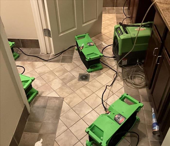
9/18/2024 (Permalink)
 If you need assistance with storm damage restoration, don’t hesitate and contact our team at SERVPRO of High Point today!
Hurricane season can be a nerve-wracking time for homeowners and businesses. Understanding what to expect and how to prepare is crucial for minimizing damage and ensuring you and the people around you are safe. This blog will provide insights into the typical hurricane season in the Northeast and offer tips on how to be prepared.
Understanding Hurricane Season
Hurricane season in the Atlantic runs from June 1 to November 30, with the peak occurring between mid-August and late October. The Northeast, including North Carolina, can experience significant impacts from these storms. According to the National Oceanic and Atmospheric Administration, the 2021 Atlantic hurricane season had 21 named storms, making it the third most active year on record.
Typical Impacts on the Northeast
Hurricanes can cause various types of damage, and knowing what to expect can help you prepare better.
Heavy Rainfall and Flooding
One of the most common issues during hurricanes is heavy rainfall leading to flooding. In High Point, NC, this can overwhelm drainage systems and cause water damage to homes and businesses. Flooding is particularly dangerous because it can happen quickly and with little warning.
High Winds
High winds from hurricanes can cause significant damage to structures, uproot trees, and lead to power outages. The strong winds can turn debris into projectiles, posing a danger to people and property.
Storm Surge
Storm surge, an abnormal rise in sea level due to a storm, can lead to severe coastal flooding. While High Point is inland, areas closer to the coast in North Carolina are at high risk for storm surge, which can have devastating effects on communities.
Preparing for Hurricane Season
Preparation is key to minimizing the impact of hurricanes. Here are some steps to take:
Create an Emergency Plan
Having a plan in place is crucial. Ensure that all family members know what to do in case of a hurricane. This includes knowing evacuation routes, having a designated meeting place, and maintaining a communication plan.
Stock Up on Supplies
Prepare an emergency kit with essentials such as water, non-perishable food, medications, batteries, and first-aid supplies. According to Ready.gov, you should have enough supplies to last at least 72 hours.
Secure Your Property
Take steps to secure your property. This includes reinforcing windows and doors, trimming trees and shrubs to prevent them from becoming projectiles, and securing outdoor furniture. Installing storm shutters can provide additional protection.
Review Insurance Coverage
Ensure that your insurance policy covers hurricane damage. Standard homeowners insurance typically covers wind damage but not flooding. Consider purchasing flood insurance, especially if you are in a flood-prone area.
What to Do During a Hurricane
Knowing what to do during a hurricane can keep you safe.
Stay Informed
Keep up to date with weather reports and alerts from reliable sources such as the National Weather Service (NWS). Knowing the latest information can help you make informed decisions.
Follow Evacuation Orders
If local authorities issue an evacuation order, follow it promptly. Evacuations are ordered for your safety, and staying behind can put you at significant risk.
Stay Indoors
If you are not in an evacuation zone, stay indoors and away from windows. The safest place during a hurricane is an interior room on the lowest level of your home.
Taking Action to Protect Your Property
Understanding and preparing for hurricane season is crucial for residents of North Carolina. By taking proactive steps, you can keep damage to a minimum and keep your loved ones safe. If you need assistance with storm damage restoration, don’t hesitate and contact our team at SERVPRO of High Point today!
Navigating Storm Season: Common Weather Hazards in North Carolina
4/15/2024 (Permalink)
Living in North Carolina means being prepared for the diverse range of weather hazards that can impact our homes and communities. From hurricanes to winter storms, understanding these common weather events is essential for protecting your property and staying safe during storm season.
1. Hurricanes and Tropical Storms
North Carolina's coastal location makes it particularly vulnerable to hurricanes and tropical storms, especially during the Atlantic hurricane season from June to November. These powerful storms bring high winds, heavy rainfall, and storm surges, posing significant threats to homes and infrastructure along the coast and inland areas.
2. Severe Thunderstorms
Severe thunderstorms are a frequent occurrence in North Carolina, especially during the spring and summer months. These storms can produce damaging winds, hail, and lightning, leading to power outages, property damage, and even injuries. It's essential to take shelter indoors and stay informed about severe weather warnings issued by local authorities.
3. Tornadoes
While tornadoes are less common in North Carolina compared to states in the Midwest, they still pose a threat, particularly during the spring and summer months. These fast-moving storms can cause widespread destruction, including significant damage to homes, trees, and infrastructure. Knowing the signs of a tornado and having a plan in place can help keep you and your family safe during a tornado event.
4. Winter Storms
In addition to warm-weather hazards, North Carolina also experiences winter storms, including snow, ice, and freezing rain. These storms can lead to hazardous road conditions, power outages, and damage from fallen trees and ice accumulation. It's essential to prepare your home and vehicle for winter weather and stay informed about weather forecasts and advisories.
5. Flash Flooding
Flash flooding is a common occurrence in North Carolina, particularly in low-lying areas and regions prone to heavy rainfall. These rapid-onset floods can pose a significant risk to life and property, washing away roads, bridges, and vehicles. It's crucial to avoid driving through flooded areas and to have a plan in place for evacuating to higher ground if necessary.
Understanding these common weather hazards in North Carolina is the first step in staying safe and protecting your property during storm season. By staying informed, preparing your home, and having a plan in place, you can weather any storm that comes your way. And remember, if disaster strikes, SERVPRO is here to help with expert storm damage restoration services tailored to your needs.
Hurricane Season 2022: How To Be Prepared
5/5/2022 (Permalink)
North Carolina is one of the "at risk" states for a hurricane. Hurricane Preparedness Week is this week and every household should have a hurricane preparedness plan ready. You can create your plan by following these steps: 1) Review your home insurance policy. Check that all your valuable possessions are covered for natural disasters such as a hurricane. 2) Know where to get hurricane alerts and information from; make sure to have different ways to receive real-time alerts. 3) Choose an evacuation route. Your family should know the route and where to find the local evacuation center too. 4) Secure your home. Install storm shutters, secure loose exterior items such as bikes and plant pots, and cut large trees.
To be prepared for a hurricane, you should have essential items on hand. Your disaster supply kit should include the following items: Water (one gallon per person per day). Food (minimum 3 day supply of non-perishable food items). Flashlight and spare batteries. Battery-powered radio to listen to local updates. Whistle for attracting attention. Medication for at least 7 days. Well stocked first aid kit. Keep all items in waterproof containers and store securely. You must also keep your cell phone charged during hurricane season and have a spare battery and charger.
Staying Safe In Your Home During A Lightening Storm
2/4/2022 (Permalink)
In addition to a direct strike, lightening can enter your home through plumbing, wiring, phone lines, even a television antenna on your roof. While the chances of being struck by lightening are remote, a strike from as far as 10 miles away can present a real danger. Here's how to stay safe:
1. Avoid plumbing altogether. No showers, baths, doing dishes or washing your hands. If you don't have to use the toilet, don't.
2.Don't touch electronics. Lightening will travel through wiring to get to the ground, so you don't want to be on anything that is plugged in.
3.Stay away from windows and doors. Metal around exterior windows and doors conducts electricity.
4. Close your blinds. Since storms often bring strong winds, and in some cases, hail, they can break windows. Closing the blinds limits how much glass or outside debris enters your home.
5.Stay away from concrete walls and floors. Be careful which surface you stand on, lie or lean against. Concrete is another conductor of electricity.
6. Wait a half hour before resuming your regular activities. Wait until 30 minutes after the last rumble of thunder before going outside, using water, or electronics. If you hear another rumble, start the count all over again. It could be a sign of another storm approaching.
Severe Storms and Their Clouds
2/4/2022 (Permalink)
Skies become ominous whenever severe weather rolls through. Within those darkened skies, however, there are clouds that you will only see during thunderstorms. Knowing what they look like and what they mean can go a long way in helping you decide when to take shelter.
1. Cumulonimbus. Possibly the most common sight during severe weather. With these clouds, strong thunderstorms are likely and severe storms are possible.
2. Shelf cloud. These foreboding clouds are typically found along the leading edge of a front or an outflow boundary from a collapsing thunderstorm. They get their name from the unusual wedge shape that they have. With these clouds, strong, possibly damaging winds could be approaching.
3. Wall cloud. They form because of the strong winds that are feeding air into the thunderstorm. With these clouds, a severe thunderstorm could produce a tornado at any moment. Seek shelter immediately and stay away from windows.
4. Funnel cloud. As the name conveys, these clouds are funnel-shaped. A funnel cloud becomes a tornado if it touches the ground or a waterspout if it touches the surface of the water. With these clouds, a tornado is imminent. Follow your tornado safety plan immediately.
5. Scud. These ragged clouds are usually found unattached to the base of a cumulonimbus cloud, shelf cloud, or the leading edge of a front. These clouds are usually harmless.
6. Mammatus. These clouds look like puffy pouches that you would see in a quilt. If associated with a cumulonimbus cloud, a severe storm could be headed your way.
Preparing for a Storm - Part 1
12/13/2021 (Permalink)
There are eight simple things that you can do now to prepare your home and help reduce the potential damage cause by severe storms.
One: Maintain your yard and balcony. Secure or store items that could blow around in strong winds. Strong winds can pick up even large items such as outdoor furniture, causing damage to roof, windows, and cars.
Two: Clean your gutters, down pipes and drains regularly to prevent blockages. Clear leaves for the valleys of your roof. Keep the drains around your property clear to help surface water move away and prevent water from pooling and entering your property.
Three: Trim trees and branches that could potentially fall on your home or property. Have a qualified arborist inspect trees every 2-3 years to identify and to identify any preventative action necessary.
Four: Fix any damage on your roof, including broken or missing tiles. Your roof should be checked every year for signs of damage. Fix any cracked, broken, or displaced tiles.
Preparing For A Storm - Part 2
12/13/2021 (Permalink)
Five: Check your insurance policy is current and adequate. Make sure your insurance policy provides cover for the types of events specific to your location, these may include: flash flood, storm water runoff, associated landslide, and damage to properties by trees.
Six: Get with your SERVPRO rep and generate an ERP. (Emergency Response Plan)Consider where you'll go and how you'll get in contact with each other along with any special circumstances or considerations for your household.
Seven: Prepare an emergency kit with essential items in case you lose power or need to leave home in an emergency. This kit should include your ERP, any essential medications or prescriptions, and any important documents.
Eight: Listen to your local radio station and other media for weather warnings. Your local radio station will broadcast information specific to your area. This information can help you identify things such as flash flooding locations to avoid, road closures, evacuation, and recovery.
Storm Season
11/8/2021 (Permalink)
The National Oceanic and Atmospheric Administrator's (NOAA) Climate Prediction Center (CPC) has updated its definition of the average hurricane season using 1991-2020 instead of 1982-2010. As a result, the "average" season now has 14 named storms and seven hurricanes, three of which will be major-Cat 3- hurricanes. The average number of named storms and the number of hurricanes increased with this change, while the number of major hurricanes remains unchanged. Therefore, the "above average" season prediction will be higher than the previous prediction for an above average season based on the changes of what is considered average.
For the first time, the National Hurricane Center (NHC) began issuing tropical weather outlooks and forecasts on May 15 instead of June 1 as it recognized that severe tropical weather is forming earlier in the calendar year. And beginning this year (2021), since the list of storm names has been exhausted, NHC will use names from a pre-determined supplemental list instead of the Greek alphabet as was past practice.
How To Keep Your Roof Safe
5/12/2021 (Permalink)
The National Storm Damage Center says that trees that are damaged by severe weather cause more than $1 billion in property damage in the United States each year. It is highly recommended that you prepare your roof for hurricane season with a thorough inspection and then addressing any issues. But, even if your roof is in pristine shape, other extraneous factors could damage your roof. It is a good idea to go around your yard and check for trees that could damage your roof. While they may look innocuous, during a storm they could wreck havoc. Check trees for overhanging branches or broken limbs. Trim them away, clearing a 10 foot radius around your house. Always keep your roof free of excessive leaves, needles, and other debris. Make sure water moves unobstructed. Excessive pools of water can rot wooden eaves and support beams. Make sure gutters and downspouts are free of debris. Check the integrity of all the trees in your yard, no matter their size. They could have hidden rot or other diseases that make it vulnerable during a storm.
Snow Storm Facts
2/12/2021 (Permalink)
Snow storms are a type of winter storm in which the main form of precipitation is snow. A snow storm is really just heavy snowfall. A snow storm is made when high pressure air has contact with low pressure air. The high pressure cold winds start blowing towards the low pressure areas. The low pressure air contains high moisture content. Clouds are formed as the hot humid air moves up, replaced by the cold air below. Then finally when precipitation occurs, the water droplets coming down freeze due to low temperatures in a region and what we get is a snow storm! If the temperature falls very much below the freezing point, an ice storm occurs. Ice storms cause multiple deaths in many countries around the world. Ice storms can take out power, glass and more.
Six More Weeks Of Winter
2/12/2021 (Permalink)
Brace yourself for six more weeks of winter. That is, if you like to get your weather prediction from a groundhog in Pennsylvania. Punxsutawney Phil saw his shadow, and as the legend holds, that means six additional weeks of heavy coats and mittens. Phil was awakened at 7:25am and made his prediction in front of about 16 members of the Punxsutawney Groundhog Club at Gobbler's Knob.
Phil is not new to the forecasting game. The ceremony has been going on since 1887. For the last two years in a row, Phil has not seen his shadow, predicting an early spring. Winter officially comes to an end on the equinox on March 20th, regardless of what Phil predicts.
In the past, Phil has been way more likely to see his shadow than not. He has reportedly seen his shadow 104 times, but not seen his shadow only 20 times. Statistically speaking, Phil has been correct in his forecasts about 50% of the time in the last 10 years.
Storm Damage And Insurance
12/21/2020 (Permalink)
Water damage caused by flooding is not covered by homeowners or renters policies because it is considered a gradual event rather than sudden or accidental. As a rule of thumb, if the water first touches the ground before entering your home, it is considered flood damage. Other examples of gradual water damage include: Water seeping though the foundation. Mold, rot or corrosion. Slow plumbing leaks that cause damage over time. Leaks stemming from clear negligence (disrepair of the roof, plumbing, windows, etc.) There are some instances when your average homeowners insurance will cover flood damage. For example, if a tree falls on your home during a storm causing heavy rains to damage the inside, this may be covered because it's a "sudden" event and the flooding did not come from the ground. Damage stemming from burst or faulty pipes, water damage that occurred while extinguishing a house fire, roof leaks or a damaged HVAC system could all potentially be covered as long as willful neglect isn't found to be the initial cause. Discerning the differences between normal flood damage and hurricane damage can be confusing. During a tropical storm, waters often rise so quickly that draining systems cannot keep up. Once more than two acres are "inundated with water", FEMA considers it a flood. The only time homeowners insurance will cover hurricane damage is if the storm itself was the reason for the flooding. For instance, if the storm broke a window and caused your home to flood. Conversely, if the damage was incurred due to a gradual buildup of groundwater, you will need flood insurance.
What Causes Thunderstorms?
12/3/2020 (Permalink)
Thunderstorms form when an air mass becomes so unstable that it overturns violently. "Unstable" means that the air in the lowest layers in unusually warm and humid, or that the upper layers are unusually cool, or oftentimes, both. Pockets of rising near surface air in an unstable air mass expand and cool, and as some of the water vapor present condenses into a cloud it releases heat, which then makes the air parcel even warmer, forcing it to rise still higher in the atmosphere. If the lower level air is sufficiently warm and humid, and the higher altitude air is sufficiently cool, this process continues until a tall convective cloud - the thunderstorm - is formed. The result can be a storm extending as high as 40,000 to 60,000 feet (8 to 12 miles). The upper portions of the storm, even in the warm tropics, are made of ice. About 50% of the rain reaching the surface in a thunderstorm originated as ice in the upper reaches of the storm.
The Significance of the letter F
12/1/2020 (Permalink)
Many of us who have lived in North Carolina for a while cringe when we hear that a tropical system with a name that starts with the letter F has formed. Some of the most destructive hurricanes that have hit the state in recent history have started with F. Hurricane FRAN was the last category 3, or major hurricane, to make landfall in North Carolina. It came inland on the evening of September 5, 1996 near the mouth of the Cape Fear River. Fran left a path of destruction from the coast to the central part of the state. Hurricane FLOYD's winds were not as strong as Fran, but its heavy rain caused more deaths and destruction than Fran. Hurricane Floyd caused an estimated $6 billion in damage and killed 57 people in the U.S. Thirty-five of those deaths were in North Carolina. More recently, hurricane FLORENCE caused flooding that was even more catastrophic than Floyd in some parts of southeastern North Carolina. Florence was a category 1 storm based on wind speed when it made landfall near Wrightsville Beach on September 14, 2018.
Tropical Storm Bertha
5/29/2020 (Permalink)
Tropical Storm Bertha formed near the South Carolina coast on Wednesday, shortly before making landfall near Charleston. A Tropical Storm Warning is in effect from Edisto Beach to the South Santee River, and heavy rainfall is expected, the National Hurricane Center said.
The center said tropical storm conditions are forecast to continue near the coast over the next few hours.
"Bertha is expected to produce total rain accumulation of 2 to 4 inches with isolated totals of 8 inches across eastern and central South Carolina into west central to far southeastern North Carolina and southwest Virginia," it said.
The rain could lead to life-threatening flash flooding and aggravate ongoing river flooding.
Bertha is the second tropical storm to form this year before the Atlantic hurricane season's official start on June 1. Tropical Storm Arthur dumped heavy rain on the East Coast earlier this month after forming near Florida.
The Associated Press reports this is the sixth year in a row that a named storm has formed before June.
After it heads inland, Bertha is expected to weaken to a tropical depression later on Wednesday, according to the hurricane center.
SERVPRO of High Point responded to several calls for basement flooding over the past couple of weeks.
Facts About Sewage
12/26/2019 (Permalink)
Sewage poses a very significant threat to human health. Any time sewage is suspected, no matter the color of the water, all suitable precautions should be observed. The severity will depend upon extent, content and degree of penetration. The health of technicians and occupants must take priority over all other considerations. Sewage situations may be classified into three categories according to extent, content and degree of penetration. The first situation exemplifies very little waste that originates in the built environment and is deposited or flows slightly beyond the confines of the sewage system. An example of this situation might be waste that overflows in a bathroom and is deposited on a tile floor. The second situation is where the water and waste penetrates the structure or furnishing of the building. An example of this situation is when flooding occurs in the fourth floor men's room of an office building, flows under a wall and into the carpet of an adjacent hall. The third situation is when waste has entered and mixed with other wastes from outside the immediate environment. The main line of the sewage system is backed up into the built environment where it is widely dispersed and penetrates the structure and the furnishings of the built environment.
Becoming Winter Ready At Work
12/2/2019 (Permalink)
Are you prepared for the upcoming cold weather? Cold weather can have a huge impact on your home or business if you are not ready for it. From heavy rain and freezing temperatures to damaging winds, sleet,or snow, all can cause serious property damage. While you cannot control the weather, you can take steps to be prepared and help take the sting out of winter weather. You need to check your business property for downed tree limbs and branches. Wind, heavy rain, ice and snow can cause branches to fall, which would cause damage to the property and potentially cause personal injuries. Also inspect walkways and parking lots, for proper drainage to alleviate a potential flood hazard. Inspect all handrails, stairwells, and entryways to address and correct potential slippery or hazardous areas. Install mats or non-slip surfaces and post caution signs where water could be present.
Becoming Winter Ready At Home
12/2/2019 (Permalink)
Roofs, water pipes, and gutters should all be inspected to help ensure they are in working order. Gutter downspouts should be directed away from your home. Clear gutters of debris that may have gathered during the Fall. Leaves and other obstructions can cause a damming effect, which can lead to roof damage and interior water problems. Protect water pipes from freezing by simply allowing water to drip when temperatures dip below freezing. If pipes are under a cabinet, leave the cabinet doors open, allowing warm inside air to circulate around the pipes. Regarding outdoor faucets, consider shutting water off at the main valve in the basement or crawl space. Once the valve is off, open the outdoor faucet to ensure it drains, preventing any remaining water from freezing in the pipe.
What Causes Thunderstorms?
6/5/2019 (Permalink)
Thunderstorms form when an air mass becomes so unstable that it overturns (convects) violently. "Unstable" means that the air in the lowest layers is unusally warm and humid, or that the upper layers are unusually cool, or oftentimes, both. Pockets of rising near-surface air in an unstable air mass expand and cool, and as some of the water vapor present condenses into a cloud it releases heat, which then makes the air parcel even warmer, forcing it to rise still higher in the atmosphere. If the lower level air is sufficiently warm and humid, and the higher altitude air is sufficiently cool, this process continues until a tall convective cloud - the thunderstorm - is formed. Thunderstorms can cause significant damage to property. Homeowners know to call SERVPRO of High Point for any water or fire related issues.
Facts about FEMA
12/27/2018 (Permalink)
If a home is destroyed in a storm that is later declared a disaster by the federal government and grants are made available, claims still need to be made through the homeowner's primary insurance company. Policyholders should understand that their home insurance is their primary source of coverage. Fema only pays AFTER insurance. When Superstorm Sandy hit the east coast in 2012, FEMA determined that there was enough damage to make an "individual assistance" declaration and they provided grants to homeowners to help them with temporary living expenditures such as finding food and shelter. The grants were not intended to rebuild their homes. The best practice is to review your insurance policy with your carrier on a yearly basis. This way you'll be current on what your coverage contains as it relates to the area where you live.
Catastrophic Claims
12/27/2018 (Permalink)
When storms hit, almost every homeowner affected files insurance claims immediately following the event. This means that insurance company adjusters are inundated with claims, phone calls and questions. Homeowners need to be patient with the process. In addition, during catastrophes, insurance companies may send in large teams of adjusters to deal with the high volume of claims. Catastrophe adjusters are often not permanent employees of the insurance company but rather contractors who are hired on a loss-by-loss basis to handle weather disasters across a nation. For that reason, they may only be available for a short time. They move on to other areas or go back home before claims are closed and then homeowners have to start again when the next group of adjusters arrive on the scene. Homeowners need to keep their own files and document everything so they won't have to start all over again when their file changes hands.
Hurricane Florence Facts
12/26/2018 (Permalink)
Hurricane Florence was a powerful and long-lived Cape Verde hurricane that caused severe damage in the Carolinas in September 2018, primarily as a result of freshwater flooding. Florence dropped a maximum total of 35.93 inches of rain in Elizabethtown, North Carolina, becoming the wettest tropical cyclone recorded in the Carolinas and also the eighth-wettest overall in the contiguous United States. The sixth named storm, third hurricane, and the first major hurricane of the 2018 Atlantic hurricane season, Florence originated from a strong tropical wave that emerged off the west coast of Africa on August 30, 2018. Steady organization resulted in the formation of a tropical depression on the next day near Cape Verde. Progressing along a steady west-northwest trajectory, the system acquired tropical storm strength on September 1, and fluctuated in strength for several days over an open ocean. An unexpected bout of rapid intensification ensued on September 4-5, culminating with Florence becoming a Category 4 major hurricane.
Hurricane Michael Facts
12/26/2018 (Permalink)
Hurricane Michael was the third most intense Atlantic hurricane to make landfall in the contiguous United States in terms of pressure, behind the 1935 Labor Day hurricane and Hurricane Camille of 1969, as well as the strongest Atlantic hurricane to form in the month of October since Hurricane Wilma. It was also the strongest storm in terms of maximum sustained wind speed to strike the contiguous United States since Andrew in 1992. In addition, it was the strongest storm on record in the Florida panhandle, and was the fourth-strongest landfalling hurricane in the United States, in terms of wind speed. By October 28, at least 60 deaths had been attributed to the storm, including 45 in the United States and 15 in Central America. Hurricane Michael caused at least $14.58 billion in damages, and at least $3.3 billion in insurance claims.
Be Prepared
9/15/2017 (Permalink)
 Good News…Bad News
Good News Bad News...
Before you end up on the roof waiting for a ride…make sure you are prepared for whatever happens. We can help get life back to normal once the storm has passed but it helps to be prepared before it arrives.
Basic Emergency Supply Kit
In celebration of National Preparedness Month here is a list of recommended items for a basic emergency supply kit:
- Water (one gallon of water per person per day)
- Food (non-perishable – 3 day supply)
- Manual can opener
- Battery operated radio, preferably an NOAA weather radio with tone alert and extra batteries.
- Flashlight and extra batteries
- First Aid kit
- Whistle (to signal for help)
- Clothing
- Dust masks or bandanas
- Plastic sheeting, garbage bags and duct tape
- Wrench or pliers to turn off utilities (if necessary)
- Local Maps
- Hygiene items
- Important documents such as copies of insurance policies, identification and bank account information
- Cash
- Fire Extinguisher
- Matches in a water proof container
Make sure you are prepared for whatever happens.


 24/7 Emergency Service